Niigata新潟県
Naeba苗場スキー場
The Naeba trail map, hand-traced run by run and painted in swirling night colours, with the numbers you need before you go and the fastest way there and back.
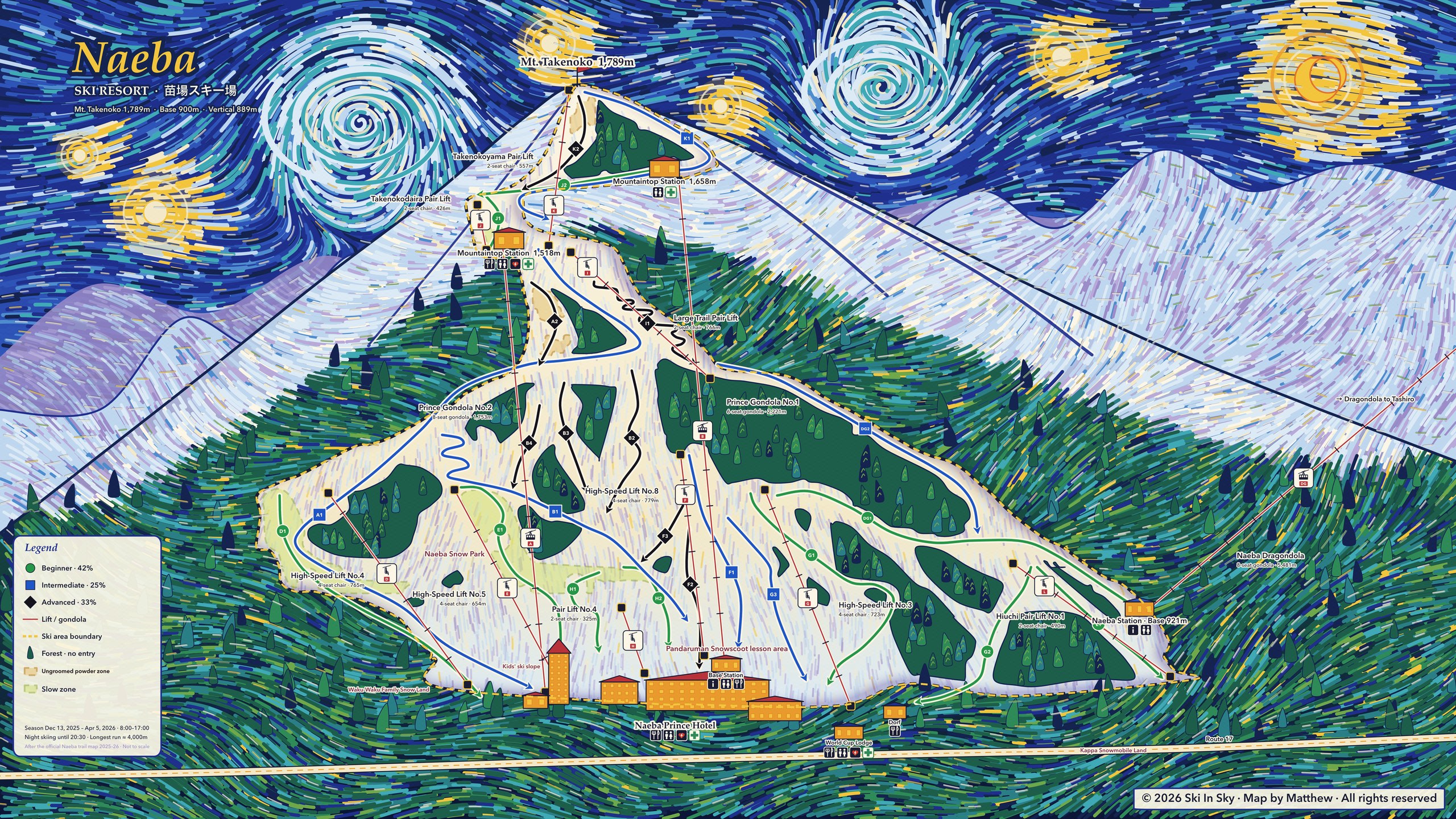 View full size ↗
Niigata新潟県
The Naeba trail map, hand-traced run by run and painted in swirling night colours, with the numbers you need before you go and the fastest way there and back.
View full size ↗Vertical
Runs
Adult day pass
10 easy · 6 intermediate · 8 advanced
Getting there and back
Last departure · Tokyo StationLast season
Step-by-step directions (in Chinese) →
Source ↗Last departure · ShinagawaLast season
Step-by-step directions (in Chinese) →
Source ↗Last departure · ShinjukuLast season
Step-by-step directions (in Chinese) →
Source ↗Last departure · OmiyaLast season
Step-by-step directions (in Chinese) →
Source ↗Last departure · Narita AirportLast season
Step-by-step directions (in Chinese) →
Source ↗Last departure · Haneda AirportLast season
Step-by-step directions (in Chinese) →
Source ↗At a glance
Season
Dec 18 – Apr 4
Source ↗Summit
1,789 m
Source ↗Base
900 m
Source ↗Vertical
889 m
Source ↗Runs
24
10 easy · 6 intermediate · 8 advanced
Source ↗Longest run
4 km
Source ↗Lifts
12
Source ↗Adult day pass
¥9,800
Source ↗Checked 2026-10-14. Every number links to its official source.
Nearby resorts
Ski in Sky is coming to the App Store.