Who it suits
Suited to confident skiers seeking varied terrain across more than one ridge, while easier runs remain available near the base.
Hokkaido北海道
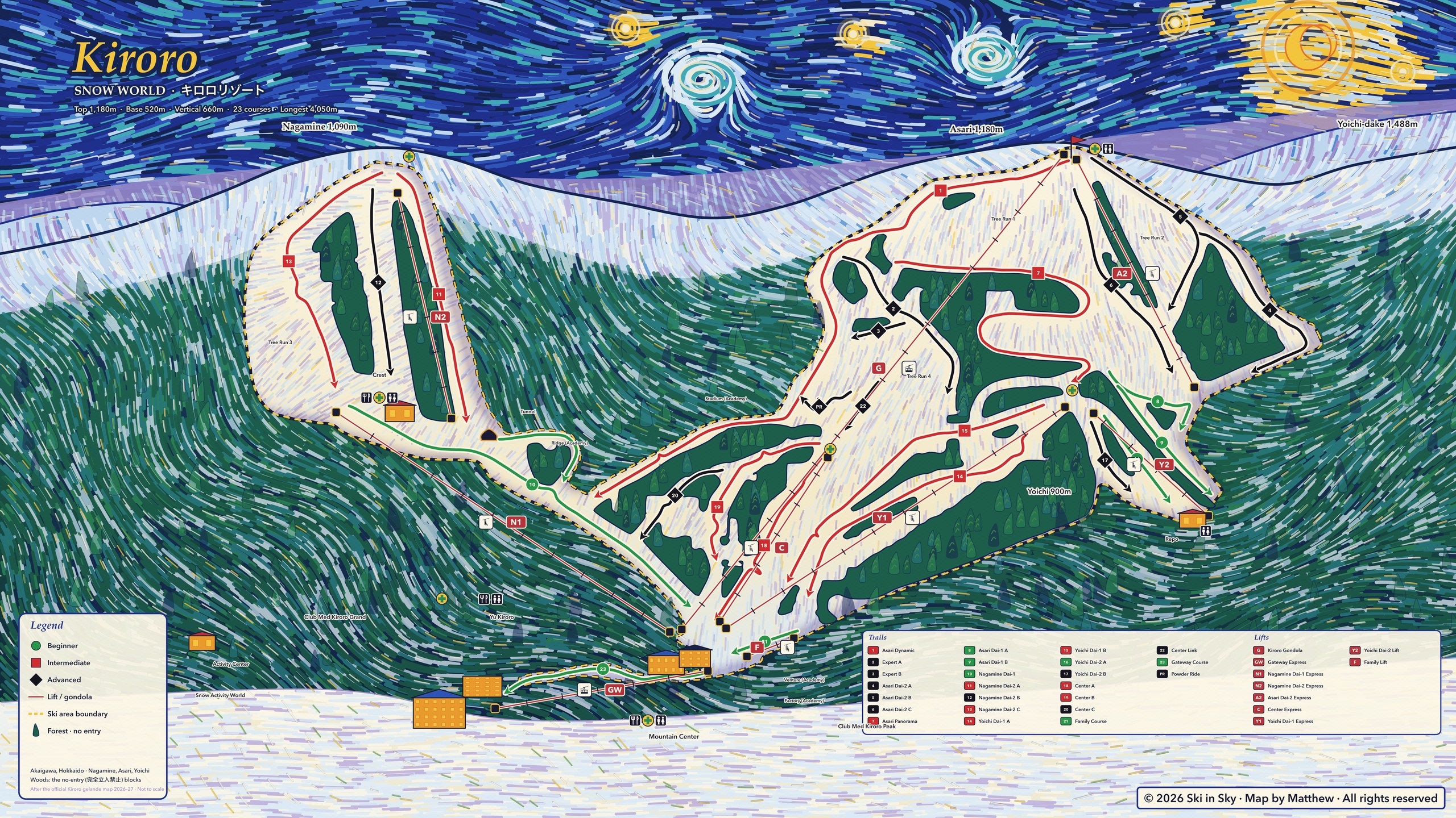
The Kiroro trail map, hand-traced run by run and painted in swirling night colours, with the numbers you need before you go and the fastest way there and back.
23 runs, summit 1,180 m, season Nov 28 – May 5, adult day pass ¥9,200, 2h07 from New Chitose Airport, last way back 16:30.
 View full size ↗
Vertical
Runs
Adult day pass
6 easy · 8 intermediate · 9 advanced
Read the mountain
Suited to confident skiers seeking varied terrain across more than one ridge, while easier runs remain available near the base.
The map separates the Nagamine, Asari and Yoichi sides. The course guide includes a substantial set of advanced runs as well as gentler routes.
Start at Mountain Center, then compare the Nagamine and Asari lift lines before choosing a ridge. The dark wooded blocks on our map are no-entry areas, not shortcuts.
Sources: Source 1 ↗
This is a planning guide; check the resort’s current open runs and lifts before skiing.
Getting there and back
Last departure · New Chitose Airport
Getting there
Take the JR Rapid Airport train from New Chitose Airport to Sapporo, then the seasonal Kiroro bus from Sapporo Station North Exit to the Mountain Center. Check its limited departures before traveling.
Step-by-step directions (in Chinese) →
Source ↗Last departure · Sapporo Station
Step-by-step directions (in Chinese) →
Source ↗At a glance
Season
Nov 28 – May 5
Source ↗Summit
1,180 m
Source ↗Base
520 m
Source ↗Vertical
660 m
Source ↗Runs
23
6 easy · 8 intermediate · 9 advanced
Source ↗Longest run
4.05 km
Source ↗Lifts
9
Source ↗Adult day pass
¥9,200
Source ↗Checked 2026-10-21. Every number links to its official source.
Advance rental reservations are listed.
See rental options ↗Children’s lessons are listed.
Lesson languages: Japanese · English · Chinese
See lessons ↗Nearby resorts
Ski in Sky is coming to the App Store.